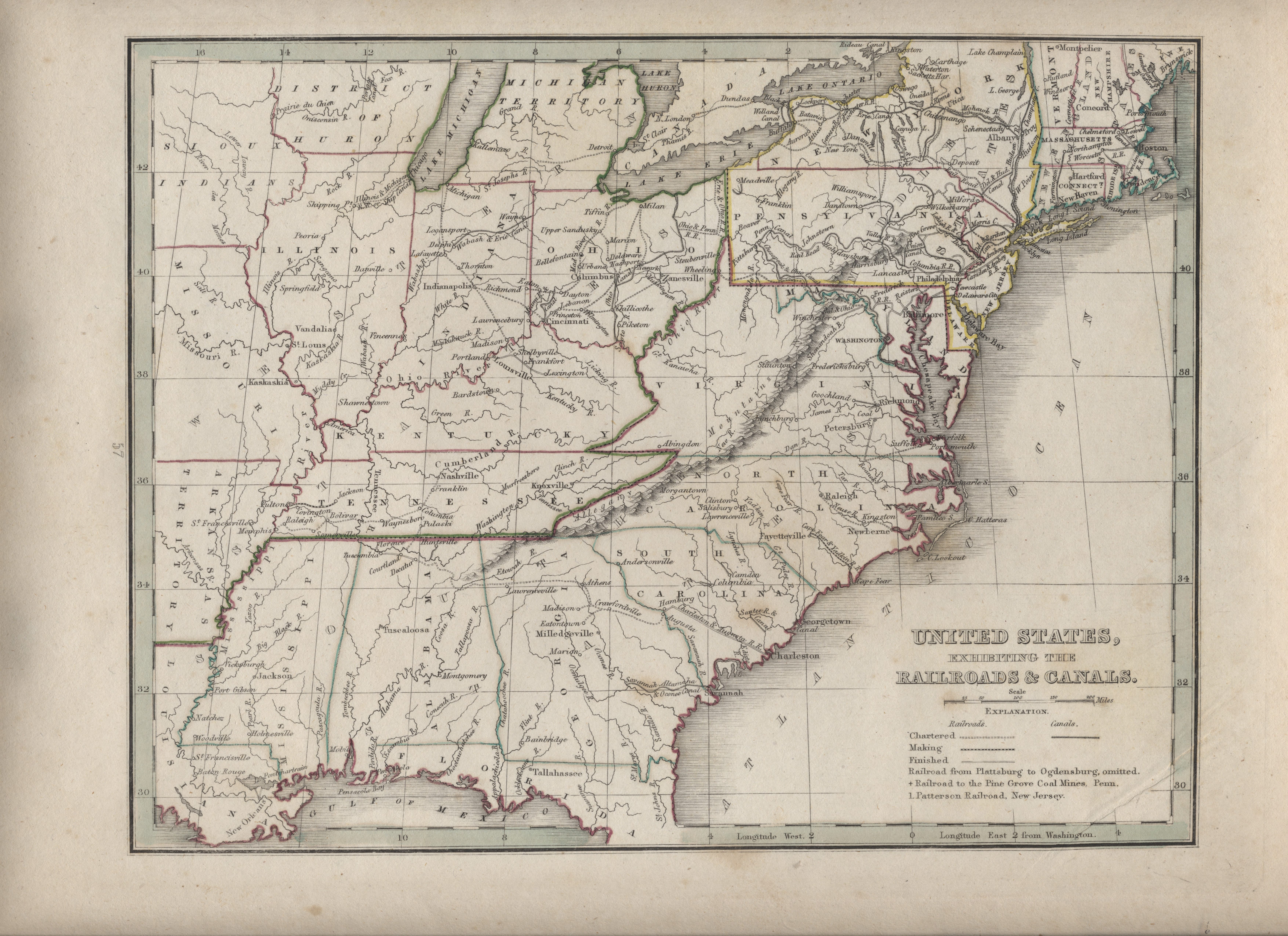
| Item: | Comprehensive Atlas Geographical, Historical and Commercial – United States Exhibiting the Railroads & Canals – 1835 |
| L.J.T.P. Number: | 500.007 |
| Medium: | Paper – 13 in. X 10 ½ in. |
| Creator: | Thomas G. Bradford |
| Publisher | Thomas G. Bradford’s 1835 Comprehensive Atlas Geographical, Historical and Commercial |
| Date: | 1835 |
| Period: | Pioneering America 1801 – 1860 |
| Keywords: | Railroad, Canal, Map, Michigan Territory |
| Citation: | Comprehensive Atlas Geographical, Historical and Commercial – United States Exhibiting the Railroads & Canals – 1835. 1835. Library of John T. Pregler, Dubuque.
(Source: Library of John T. Pregler) |
| Remarks: | Map shows Michigan Territory and the District of Huron (present day Wisconsin) along with Arkansas Territory. Map also marks the “Sioux Indians” in present day Iowa. |