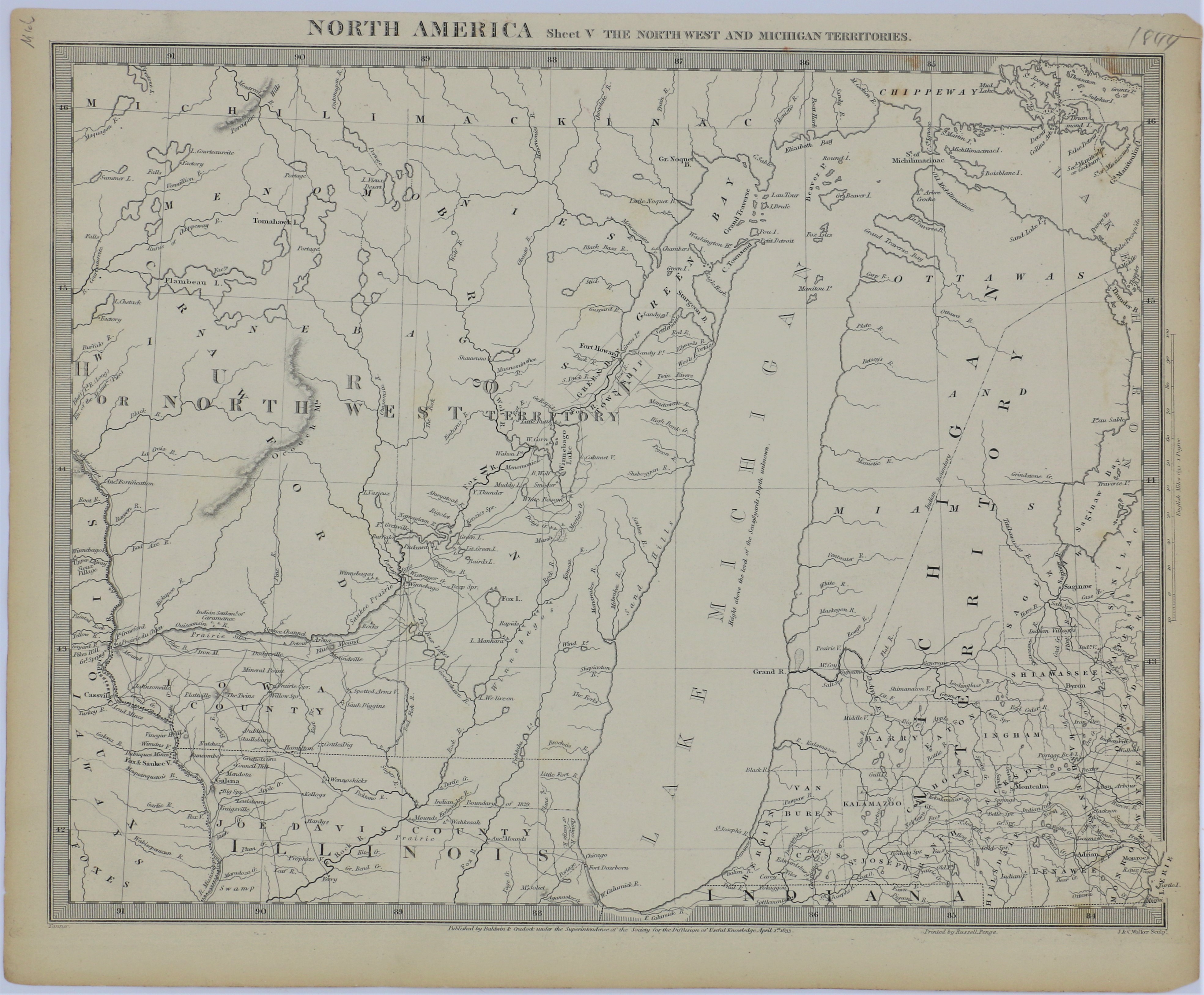
| Item: | Society of the Diffusion of Useful Knowledge – North America – Sheet V The North West and Michigan Territories – 1833 |
| L.J.T.P. Number: | 500.005 |
| Medium: | Paper – 16 in. X 12 ¼ in. |
| Creator: | J & C Walker, Sculp. / Printed by Russell Penge |
| Publisher | Baldwin & Cradock under the Supervision of the Society of the Diffusion of Useful Knowledge |
| Date: | April 1, 1833 |
| Period: | Pioneering America 1801 – 1860 |
| Keywords: | Michigan Territory, North West Territory, Map, Dubuque Mines |
| Citation: | Society of the Diffusion of Useful Knowledge – North America – Sheet V The North West and Michigan Territories – 1833. 1833. Library of John T. Pregler, Dubuque.
(Source: Library of John T. Pregler) |
| Remarks: | Map marks “Dubuques Mines” and shows the locations of Native American villages around eastern Iowa, northern Illinois and Wisconsin. Map marks Ft. Crawford at the confluence of the Mississippi River and the Ouisconsin River (present day Wisconsin River). Shows Michigan Territory and Huron or North West Territory (present day Wisconsin). |