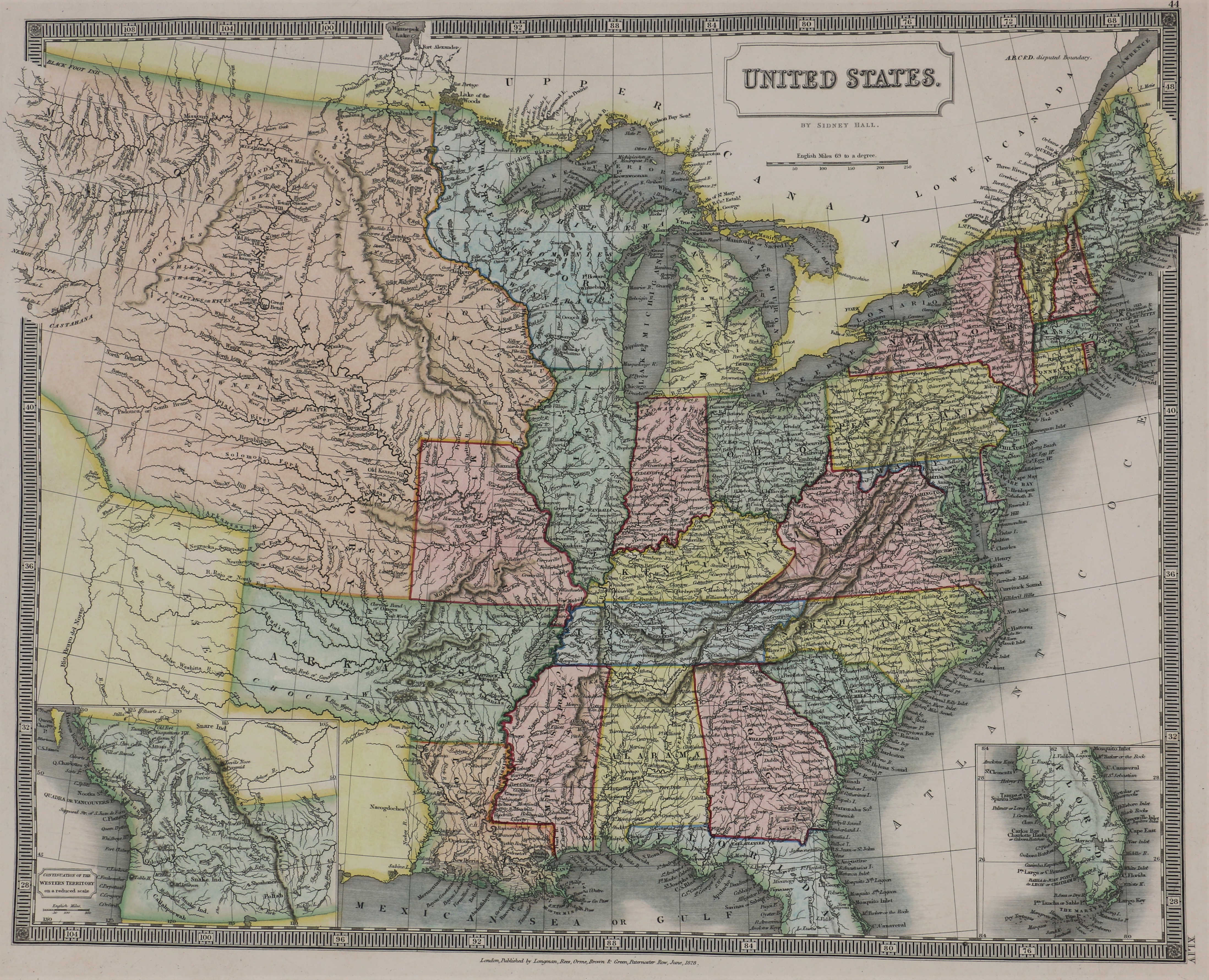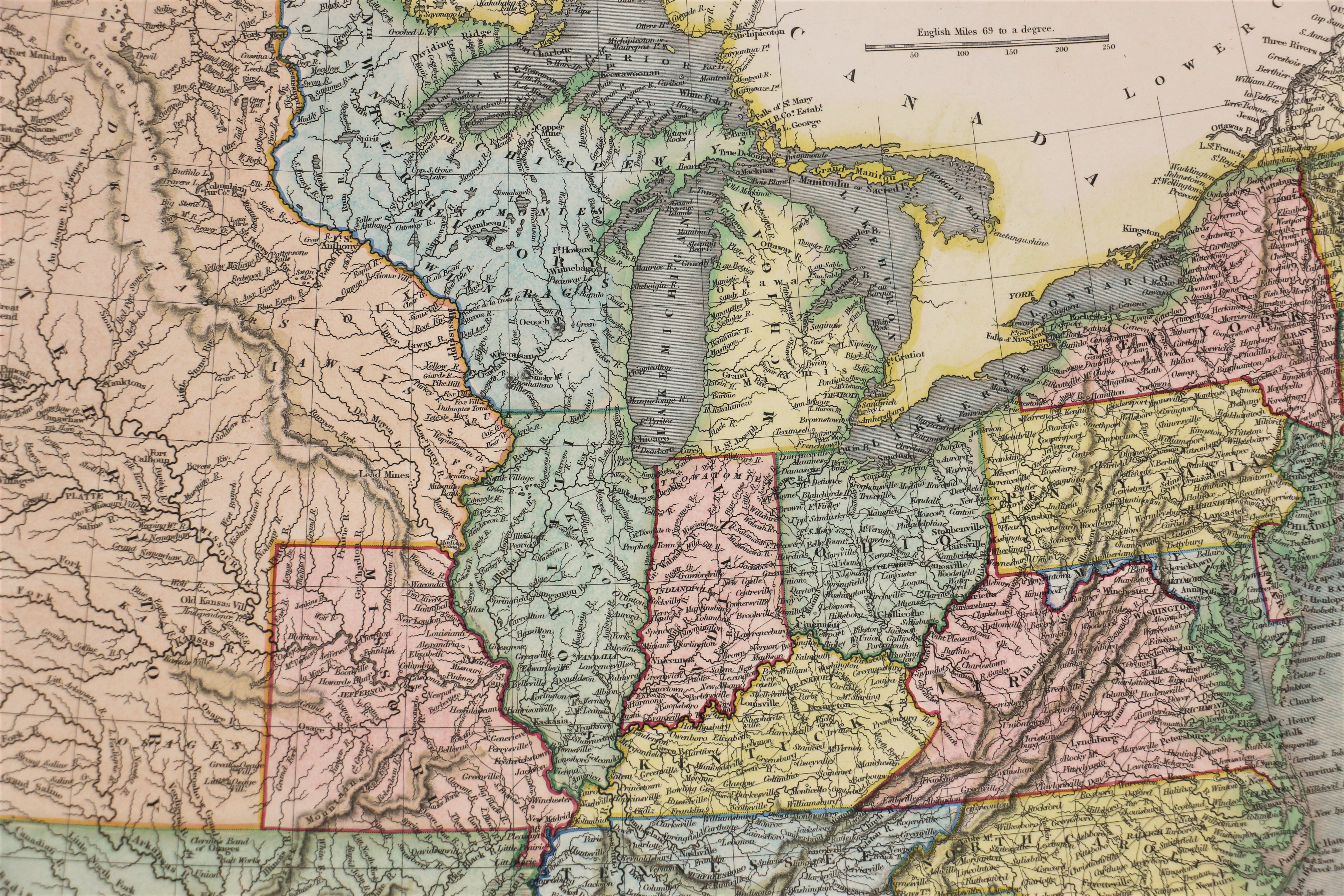
| Item: | Sidney Hall – United States – 1828 |
| L.J.T.P. Number: | 500.006 |
| Medium: | Paper – 23 in. X 19 in. |
| Creator: | Sidney Hall |
| Publisher | Longman, Rees, Orme, Brown & Green – Paternoster Row, London |
| Date: | 1830 |
| Period: | Pioneering America 1801 – 1860 |
| Keywords: | Michigan Territory, North West Territory, Map, Dubuque’s Tomb, Sidney Hall |
| Citation: | Sidney Hall – United States – 1828. 1830. Library of John T. Pregler, Dubuque.
(Source: Library of John T. Pregler) |
| Remarks: | Map marks “Dubuques Tomb” and shows the locations of Native American villages around eastern Iowa, northern Illinois and Wisconsin. Map also marks Ft. Crawford at the confluence of the Mississippi River and the Wisconsin River. Shows North West Territory (present day Wisconsin) and Missouri Territory (present day Iowa, Minnesota, Kansas, Nebraska and the Dakotas). |